
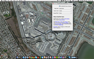
satellite-eyes
Mac OS X app to automatically set your desktop wallpaper to the satellite view o
Objective-C657other
6 months ago
desktop-wallpaperoverheadsatellite
mqttpc
Advanced process control via MQTT :satellite:
JavaScript10mit
8 months ago
mqttprocess-managerstdin

techniques
Techniques for deep learning with satellite & aerial imagery
7756apache-2.0
2 days ago
convolutional-neural-networksdatasetdatasets

raster-vision
An open source library and framework for deep learning on satellite and aerial i
Python1966other
2 months ago
classificationcomputer-visiondeep-learning
pyroSAR
framework for large-scale SAR satellite data processing
Python469mit
15 hours ago
earth-observationgdalpython

awesome-sentinel
Description Put the Earth in your pocket !SnapPlanet is the first app for eve
521cc-by-4.0
6 months ago
awesome-listhacktoberfestopen-data

gpslogger
:satellite: Lightweight GPS Logging Application For Android.
Java1849other
3 days ago
androidandroid-sdkdropbox
satpy
Python package for earth-observing satellite data processing
Python1008gpl-3.0
15 hours ago
closemberdaskhacktoberfest

Look4Sat
Open-source satellite tracker and pass predictor for Android, inspired by Gpredi
Kotlin534gpl-3.0
2 months ago
amsatandroidgpredict

SatIntel
SatIntel is an OSINT tool for Satellites 🛰. Extract satellite telemetry, receiv
Go377other
10 months ago
aerospacecybersecuritygolang
SatDump
A generic satellite data processing software.
C++1145gpl-3.0
5 hours ago
basebandccsdsdigital-signal-processing

sentinelsat
Search and download Copernicus Sentinel satellite images
Python955gpl-3.0
2 months ago
copernicusesageographic-data

imagery-index
🛰 An index of aerial and satellite imagery useful for mapping
JavaScript27other
11 months ago
aerial-imageryimagerysatellite-imagery


awesome-satellite-imagery-datasets
🛰️ List of satellite image training datasets with annotations for computer visi
3231mit
2 years ago
computer-visiondeep-learningearth-observation
satellite-image-deep-learning
Deep learning with satellite & aerial imagery
5620apache-2.0
last year
convolutional-neural-networksdatasetdatasets
orbit
:satellite: A cross-platform task runner for executing commands and generating f
Go179mit
3 years ago
gogolangtask-runner
mqttDB
JSON Store with MQTT Interface :books::open_file_folder::satellite:
JavaScript25mit
6 years ago
databasedocumentsjson
rpi2mqtt
Connect RaspberryPi GPIOs and 1-Wire temperature sensors to MQTT :cake::radio_bu
JavaScript22mit
6 years ago
1-wiregpioiot
unifi2mqtt
Connect Ubiquiti UniFi controller to MQTT :satellite:
JavaScript72mit
4 years ago
clientmqttsmarthome

robosat
Semantic segmentation on aerial and satellite imagery. Extracts features such a
Python1996mit
4 years ago
aerial-imagerymachine-learningopenstreetmap
MotionKit
Get the data from Accelerometer, Gyroscope and Magnetometer in only Two or a few
Swift1082mit
6 years ago
predict.cr
Satellite prediction library for crystal using the sgp4 model
C++17mit
4 years ago
crystalsatellitesatellite-prediction
DeepOSM
Train a deep learning net with OpenStreetMap features and satellite imagery.
Python1304mit
7 years ago

SpaceEye
Description Make live satellite imagery of Earth your desktop background with
TypeScript319mit
last year
desktop-backgroundelectrongoes-16
awesome-earthobservation-code
A curated list of awesome tools, tutorials, code, projects, links, stuff about E
HTML1019cc0-1.0
last year
awesomeawesome-listearth-observation
react-native-ibeacon
:satellite: iBeacon support for React Native
Objective-C371mit
6 years ago
beaconibeacon-supportreact-native

deep-learning-roadmap
:satellite: All You Need to Know About Deep Learning - A kick-starter
Python4548mit
last year
deep-learningresources
awesome-rtc
:satellite: A curated list of awesome Real Time Communications resources
320cc0-1.0
2 years ago
awesomeawesome-listreal-time-communications
preact-portal
:satellite: Render Preact components in (a) SPACE :milky_way: :stars:
JavaScript179mit
4 years ago
dompreactpreact-components
imagery-index
🛰 An index of aerial and satellite imagery useful for mapping
JavaScript26other
last year
aerial-imageryimagerysatellite-imagery
Sen2Agri-System
Sentinel-2 for Agriculture (Sen2Agri) is a software system processing high resol
HTML112other
3 years ago
agriculturalesagdal